

MICHIGAN — According to the National Weather Service in Gaylord, an arctic air mass is predicted to affect Michigan early next week, with Monday through Tuesday being the most dangerous time.
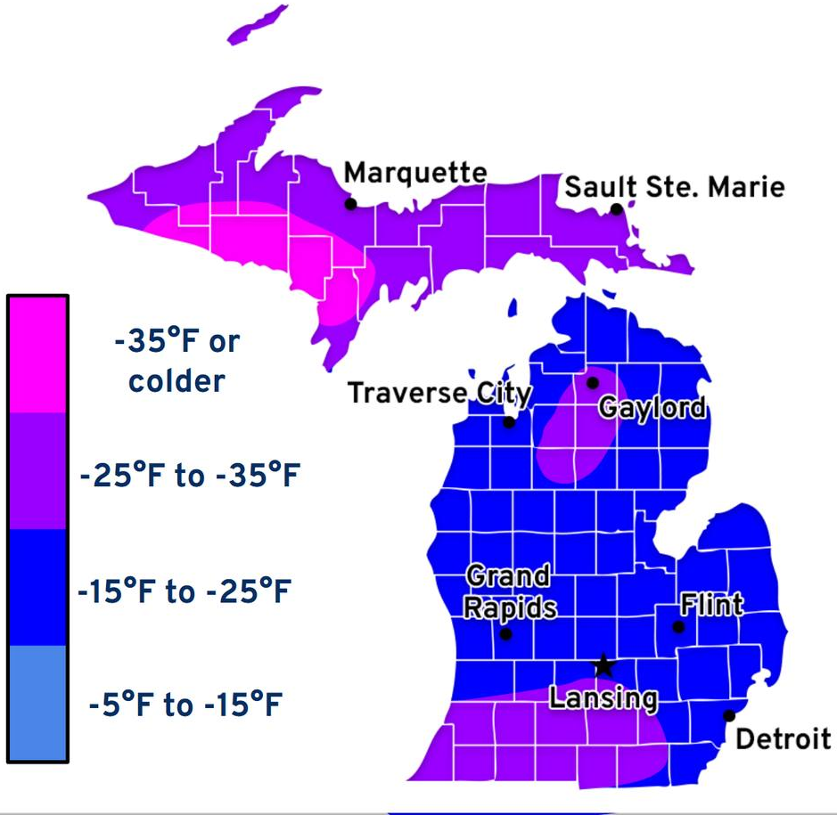
The entire Upper Peninsula is currently highlighted in dark purple (-25f to -35f), with some areas being bright pink, signifying wind chills of -35°F or colder, in an image released by the National Weather Service in Gaylord that depicts severe wind chills throughout much of the state. Most of the Lower Peninsula is highlighted in dark blue (-15f to -25f), with some portions, mostly south of Lansing, being dark purple.
In addition to the cold, some places may experience lake-effect snow, which could make travel dangerous.
Long-term exposure to these circumstances may be dangerous. In addition to hypothermia for people without appropriate winter clothing or shelter, frostbite can happen on exposed skin in a matter of minutes. Electronics and vehicles may also be affected by cold temperatures.
Confusion, shivering, difficulty speaking, drowsiness, and stiff muscles are some signs of hypothermia. If you or anyone else show these symptoms, get to a warm place and get medical attention.
It is recommended that residents wear multiple layers of clothing, avoid travel unless absolutely necessary, as salt will most likely be ineffective. Make sure emergency supplies are on hand, especially for travel. As confidence in the event grows, the National Weather Service advises keeping an eye on forecast updates.
How to get ready for severe cold: Cold Weather Safety
As new information becomes available, this story will be updated.
Last Updated: 1/15/2026, 6:50pm.
U.P Response Media is not a weather forecasting agency. Information provided is sourced from the National Weather Service.*
– Lucas, U.P. Response Media